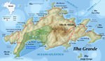
Map of cities in Brazil

Map of cities in Brazil
The actual dimensions of the Brazil map are 1094 X 953 pixels, file size (in bytes) - 344486. You can open, print or download it by clicking on the map or via this link: Open the map of Brazil.
Map of cities in Brazil
The actual dimensions of the Brazil map are 1940 X 2000 pixels, file size (in bytes) - 481129. You can open, print or download it by clicking on the map or via this link: Open the map of Brazil.

Additional maps of Brazil

Map of cities and regions in Brazil

More to see in Brazil
The Brazilian city of Maceio is quite a calm and safe place that is why so many Brazilians choose it as their vacation destination. Tourists and people from the continent come here to enjoy trouble-free recreation at the ocean coast, lie on the beaches under coconut palm trees, and walk on picturesque waterfronts that offer heartwarming views of the ocean. Maceio itself is a large port, so it is not rare to see numerous colorfully painted boats of local fishermen. Just like other resorts, this city has its own peculiarity and attraction – naturally formed pools that appear at the coast during the low tide. The area of the Brazilian megalopolis was discovered by European naval explorers in 1609. Having stepped on this land, Europeans quickly noticed that this region is perfectly suitable for agriculture. The first settlement on the site of modern Maceio appeared soon after the discovery. Slowly, immigrants from different European countries started settling in Brazil. They were exploring wild areas, building new fazendas, and making plantations. Year after year, the settlement was developing and expanding. The population of Maceio was increasing as well. Cultivating sugarcane became very popular in the region, and so big sugarcane plantations appeared near Maceio. Fruit …
Top sights in Brazil

Casa de Pedra

From the series “The Most Bizarre and Fancy Living Houses”
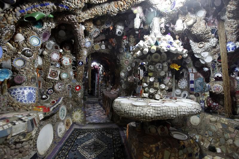
The original dwellings can be found not only in the elite districts of the big metropolises. A really unique house is located in the Elander district of São Paulo. The house called Casa-de-Pedra was built by the ordinary local gardener. Just a few years ago, the poor gardener had no money to build the smallest house. He found the simple exit from the complicated situation and built the house from the various materials that have come to pass.

The wooden beams, the pebbles and the ceramic cuttings, the old dishes and the cement - the simple gardener built the unique house from these simple and free building materials. And the 'modest' dwelling is one of the most beautiful in São Paulo and is often compared to the masterpieces of Antonio Gaudi. The housekeeper has nothing to say about … Read all

Congonhas Airport

From the series “The Most Dangerous Runways in the World”
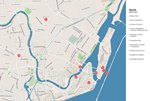
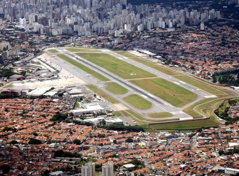
Congonhas Airport, located in the center of São Paulo, is probably the airport with the most slippery runways in the world. The bad drainage system in this case is the main danger for the experienced pilots. At present, the airport has two runways, the length of which is 1 435 and 1 940 meters. The general public is familiar with the large airport of São Paulo due to a series of terrible aircraft crashes.

One of the first aircraft crashes near the airport happened in 1941. The plane, which was approaching the Congonha airport, could not overcome the mountain massif and crashed. The number of victims was 13 people. Three years later, the fog surrounding the city became the cause of the accident, which cost 16 lives.

Most aircraft crashes of the past 70 years have happened at night. … Read all
All unique sightseeing Brazil
 

Culture of regions in Brazil

Secure Connection
Main Office
Weegschaalstraat 3, Eindhoven
5632 CW, The Netherlands
+31 40 40 150 44


Terms of Service | Privacy Policy | About us
Copyright © 2002 - OrangeSmile Tours B.V. | Incorporated by IVRA Holding B.V. - Registered in The Dutch Chamber of Commerce (Kamer van Koophandel KvK, The Netherlands) No. 17237018