Maps of US Virgin Islands

Detailed map US Virgin Islands
The actual dimensions of the US Virgin Islands map are 3331 X 2378 pixels, file size (in bytes) - 423089. You can open, print or download it by clicking on the map or via this link: Open the map of US Virgin Islands.

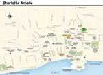
Maps of cities and regions of US Virgin Islands

More to see in US Virgin Islands
The Virgin Islands are a true gem of the Caribbean. The fabulous city of Charlotte Amalie is the main destination on the islands. This settlement is the capital of the U.S. Virgin Islands. The charming resort city is situated on the largest island of the group, Saint Thomas. Nowadays, Charlotte Amalie is a popular tourist destination that attracts guests from all over the world. Tourists from different countries arrive to sunbathe in the rays of the Caribbean sun, enjoy swimming in warm water, and admire the natural beauty of this region. The information about the first settlers on Saint Thomas dates back to the period when Christopher Columbus made his second journey. These were several American Indian tribes, such as the Taino, Arawaks, and Caribs. However, Charlotte Amalie started developing after the region had established business relations with Dutch colonies in the West Indies. Charlotte Amalie as a town has existed since 1671. This is when Dutch King Christian V made an order to found a new settlement. Initially, the city had another name – Taphus. This word means “beer house” in Dutch. Twenty years later, the city changed its name to Charlotte Amalie to honor Christian V’s wife. It was decided to build Fort Christian at the beginning of the 70s of the 17th …
Secure Connection
Main Office
Weegschaalstraat 3, Eindhoven
5632 CW, The Netherlands
+31 40 40 150 44


Terms of Service | Privacy Policy | About us
Copyright © 2002 - OrangeSmile Tours B.V. | Incorporated by IVRA Holding B.V. - Registered in The Dutch Chamber of Commerce (Kamer van Koophandel KvK, The Netherlands) No. 17237018