Detailed hi-res maps of Kotor for download or print

Large map of Kotor 1
The actual dimensions of the Kotor map are 1356 X 792 pixels, file size (in bytes) - 209740. You can open this downloadable and printable map of Kotor by clicking on the map itself or via this link: Open the map.
Detailed map of Kotor 2
The actual dimensions of the Kotor map are 880 X 1024 pixels, file size (in bytes) - 258004. You can open, download and print this detailed map of Kotor by clicking on the map itself or via this link: Open the map.
Large map of Kotor 3
The actual dimensions of the Kotor map are 1082 X 727 pixels, file size (in bytes) - 209625. You can open this downloadable and printable map of Kotor by clicking on the map itself or via this link: Open the map.
More to see in Kotor
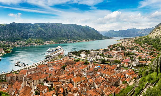
Kotor, a beautiful town in Montenegro, is situated in a natural triangle formed by the Shkudra River, Saint Ivan Mount, and the Adriatic Sea. For tourists, this place is of great interest not only because of its centuries-old historical past but also for climatic conditions that make this coastal town a wonderful holiday choice. When taking a stroll in the streets of the town, tourists need to stay alert because it is so easy to get lost here. The town’s layout is reminiscent of a labyrinth. Sometimes even local people get lost and wander searching for the place that they needed. This fact doesn’t make a stay in Kotor less pleasant. Quite the opposite, it only makes this place even more mysterious and interesting. The history of Kotor started many centuries ago. Archaeologists discovered many interesting rock drawings that belong to yet prehistoric times, various ceramic items, and instruments. This fact proves that there were people in this part of Montenegro yet during the Neolithic period. Starting from the 60s of the 2nd century, Romans were the rulers in the territory of modern Kotor. After them, the Byzantine Empire captured the region. This is exactly when Kotor is mentioned in historic annals for the first time. During the reign of the Byzantine Empire, the town was under the occupation of the Bulgarian Empire, and then the Grand Principality of Serbia captured the settlement for a short period. During the Serbian period that lasted until 1371, Kotor … Read further

Our guide chapters over Kotor

Kotor sightseeing

Do you prefer wild beaches to organized ones? Bajova Kula Beach is the best choice in this case. This is quite a small beach that occupies only sixty meters of the coastal area. Bajova Kula Beach is situated approximately ten kilometers from Kotor. It is possible to reach it by motorboat. Regardless of the fact that this is a wild beach, it has quite well-developed infrastructure. Visitors can lie on the pontoon or … Open

Detailed maps of neighbouring cities to Kotor

Secure Connection
Main Office
Weegschaalstraat 3, Eindhoven
5632 CW, The Netherlands
+31 40 40 150 44


Terms of Service | Privacy Policy | About us
Copyright © 2002 - OrangeSmile Tours B.V. | Incorporated by IVRA Holding B.V. - Registered in The Dutch Chamber of Commerce (Kamer van Koophandel KvK, The Netherlands) No. 17237018