Provinces map of Ireland

Map of regions in Ireland
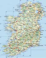
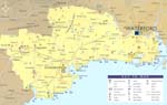
The actual dimensions of the Ireland map are 1713 X 2000 pixels, file size (in bytes) - 434943. You can open, print or download it by clicking on the map or via this link: Open the map of Ireland.

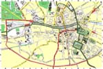
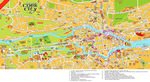
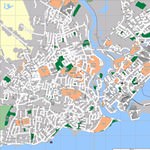
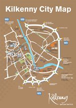
Other maps of Ireland

Map of cities and regions in Ireland

More to see in Ireland
Dublin Castle is the main historical attraction of the city. The beautiful construction was built during the colonial era. This is a powerful fortification with thick walls surrounded by a high stone wall and a moat. For many centuries the castle has remained an impregnable fortress. Today the territory of the old castle is open to public. Thanks to the fact that during its existence the castle has not been ambushed, the building has survived to this day in its original form. Today the spacious halls of the fortress are used for various celebrations and official meetings. Visitors of the city will be interested in walking in the territory of the castle and looking to its inner premises. The territory of the fortress is also home to old Gothic church of Most Holy Trinity, which is definitely worth visiting. Speaking of religious sites of the city, we simply cannot fail to mention St. Patrick's Church as this is the largest building of its kind in Ireland. The opening of the church took place in the first half of the 13th century. During its long history the church was repeatedly destroyed and rebuilt. The only element of the buildings that has survived from the very first church is a font, which is located above the old chapel. The church houses many interesting sculptures and …

Cuisine and restaurants of Ireland

Secure Connection
Main Office
Weegschaalstraat 3, Eindhoven
5632 CW, The Netherlands
+31 40 40 150 44


Terms of Service | Privacy Policy | About us
Copyright © 2002 - OrangeSmile Tours B.V. | Incorporated by IVRA Holding B.V. - Registered in The Dutch Chamber of Commerce (Kamer van Koophandel KvK, The Netherlands) No. 17237018