Detailed hi-res maps of Jacksonville for download or print

Large map of Jacksonville 1
The actual dimensions of the Jacksonville map are 1152 X 1006 pixels, file size (in bytes) - 363713. You can open this downloadable and printable map of Jacksonville by clicking on the map itself or via this link: Open the map.
Detailed map of Jacksonville 2
The actual dimensions of the Jacksonville map are 1530 X 1014 pixels, file size (in bytes) - 287380. You can open, download and print this detailed map of Jacksonville by clicking on the map itself or via this link: Open the map.
Large map of Jacksonville 3
The actual dimensions of the Jacksonville map are 1200 X 1601 pixels, file size (in bytes) - 372996. You can open this downloadable and printable map of Jacksonville by clicking on the map itself or via this link: Open the map.
Detailed map of Jacksonville 4
The actual dimensions of the Jacksonville map are 1527 X 2000 pixels, file size (in bytes) - 896402. You can open, download and print this detailed map of Jacksonville by clicking on the map itself or via this link: Open the map.
More to see in Jacksonville
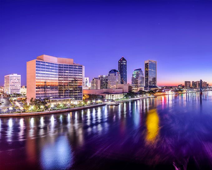
There are many large cities in Florida, and Jacksonville is one of them. In modern times, this is a rapidly developing urban center, and this fact has a beneficial impact on the prosperity of local people, and, naturally, on the size of Jacksonville’s population. Tourists also enjoy visiting this city because of the gorgeous old districts of Jacksonville that still have many historical buildings, an interesting location on the St. Johns River, beautiful waterfronts, and a large number of museums. The territory of modern Jacksonville was one of the earliest settlements in the territory of the United States. The first settlement in the area, Ossachite, appeared approximately 6,000 years ago. At that time, the Timucua people lived there. Europeans appeared in this part of the American land only in the 60s of the 16th century. This is when French Huguenot explorer Jean Ribault landed on the bank of the St. Johns River. After that, the river appeared on the map. Two years after this event, the first European settlement on the river – Fort Caroline – was established. This territory became a part of the United States only in the first part of the 19th century. This is when the city got its current name. Jacksonville got its name after the seventh President of the United States of America. During the Civil War period, in 1864, the biggest battle in Florida, the Battle of Olustee, took place near Jacksonville. Even though the city remained safe and didn’t get any … Read further

Our guide chapters over Jacksonville

Jacksonville sightseeing

During the Civil War period, in 1864, the biggest battle in Florida, the Battle of Olustee, took place near Jacksonville. Even though the city remained safe and didn’t get any damage, the war had a negative effect on the economy of the region. In 1867, Jacksonville turned into a winter resort that attracted celebrities and rich people. When the Second World War started, it was decided to make a naval base in … Open

Detailed maps of neighbouring cities to Jacksonville

Secure Connection
Main Office
Weegschaalstraat 3, Eindhoven
5632 CW, The Netherlands
+31 40 40 150 44


Terms of Service | Privacy Policy | About us
Copyright © 2002 - OrangeSmile Tours B.V. | Incorporated by IVRA Holding B.V. - Registered in The Dutch Chamber of Commerce (Kamer van Koophandel KvK, The Netherlands) No. 17237018